Featured post

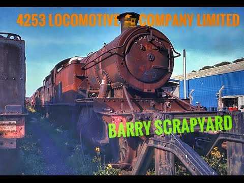
Abandoned and Disused at Barry Scrapyard to the Kent and East Sussex Railway 4253

A Old Abandoned Rusty Train In Barry Scrapyard.  now plan are at thought to rebuild the loco to support the future extension of KES...

Showing posts with label stations. Show all posts

Thursday, 2 March 2017

Wittersham Road . and the World war 2 big guns at the Kent and East Sussex Railway


the original station site was largely cleared by British Railways


But for the reopening in 1978 the railway provided a station platform using coping stones from Heathfield station in Sussex.


The platform footpath is flanked by railings retrieved from Cranbrook, another station on a Stephens' railway, and lamp standards from Ashurst and Cowden. The Station nameboard also originated from Cranbrook. The signal box is a Saxby and Farmer type 5 box from Deal Junction, Dover built about 1882 and transported here for the opening of the rebuilt station. The yard here is somewhat extended from its old role as a busy agricultural goods yard and is currently used as the Permanent Way Headquarters for the Railway and as a relatively vandal free storage site for rolling stock in need of renovation.

The station building is set at right angles to the line and closely resembles the original but came from the Cambrian Railways at Borth in West Wales where it had been since the 1890's. Opposite this building across the station yard, where stock coming to and from the railway is loaded, is a relic of World War II. By the picnic site the small Blockhouse was built as an ammunition store for one of a pair of 'super heavy' 9.2" rail-mounted guns that were based on the railway from February 1941 to 8th August 1944. They had a range of some 20 miles and would have been used to fire on the beaches edging Romney Marsh in the event of invasion.

Saturday, 25 February 2017

Disused , Abandoned Lydd Town Station (formerly Lydd Station)

                     Disused , Abandoned   Lydd Town Station (formerly Lydd Station)


You Tube 

Opened on 7 December 1881 as Lydd Station, on 4 July 1937 the station was renamed Lydd
Town to prevent confusion with a newly opened station at Lydd-on-Sea.
google photo


 One of my favourite abandoned stations 
Lydd Town Station (formerly Lydd Station) (Closed) and Lydd Town Crossing


Opened on 7 December 1881 as Lydd Station, on 4 July 1937 the station was renamed Lydd Town to prevent confusion with a newly opened station at Lydd-on-Sea


Lydd Town Station was a substantial facility, with a large goods yard and much passenger and freight traffic generated by nearby army camps. 


A branch ran south from the goods yard into the army camps, which were served by Lydd Military Railway.


 A passing loop was provided at the station, but this has subsequently been lifted. The station was closed to passenger traffic on 6 March 1967 and to freight on 4 October 1971. Part of the site is now used as a recycling facility.
PHOTO Framemepleae2017


The passing loop was reinstated to allow locomotives to change ends and shunt the train.


The Lydd Railway Company's 11-mile branch to Dungeness opened to freight services in December 1881. Initially passenger trains terminated at Lydd. The line's promoters hoped that creating a rail link between London and Dungeness would lead to the development of a port from which cross-channel steamers could operate. But this grand plan failed to materialise and the branch was left to stagnate. It did though carry some shingle traffic as well as flints for the Potteries where they were used to glaze china. Many army trains travelled to Lydd where a private military railway system had a connection onto the main line.

The branch actually runs south east from Appledore. The convention adopted in these collections is that Appledore is north, Dungeness is south, the New Romney side of the branch is east, and the Lydd side of the branch 


PHOTO Framemepleae2017

PHOTO Framemepleae2017

PHOTO Framemepleae2017

PHOTO Framemepleae2017

PHOTO Framemepleae2017

PHOTO Framemepleae2017

Bodiam Station on the Kent and East Sussex Railway

                                    Bodiam Station on the Kent and East Sussex Railway
Location
PlaceBodiam
AreaRother, East Sussex
Grid referenceTQ783249
Operations
Original companyRother Valley Railway
Pre-groupingKent and East Sussex Railway
Post-groupingSouthern Region of British Railways
Platforms1
History
2 April 1900Opened
4 January 1954Closed regular passenger service
June 1961closed completely
2 April 2000Reopened
Situated half a mile from the Bodiam village itself and its fourteenth century castle, the station opened in 1900 in a rather remote and rural location.

 It was surrounded by hop fields, mainly owned by Guinness, and helped to serve the industry in the area, bringing hop-pickers to and from the fields and transporting hops to the breweries. In 1910.


Add cap
A siding was added which effectively acted as a loop allowing freight trains to pass passenger trains. The station was known as "Bodiam for Staplecross".


In keeping with other stations on the line, the main station building was fitted out in typical spartan style. Only Gents toilet facilities were available and the urinal was flushed using water gathered in the building's rainwater pipe.

Dwindling passenger numbers and increased competition from road hauliers saw the line close to regular passenger services in 1954 but freight and occasional special passenger trains used the line until 1961.


 It was subsequently rescued in 1971 by the Tenterden Railway Company (now the Kent and East Sussex Railway) who purchased the line between Tenterden and Bodiam for £60,000. Its extension to Bodiam was completed in 2000 and the station now marks the line's southern terminus.

The Cavell Van, the railway van that conveyed Edith Cavell's remains from Dover to London is kept as a memorial and is usually open to view at Bodiam railway station. The van also carried the bodies of Charles Fryatt and The Unknown Warrior.

 Bodiam Castle (/ˈboÊŠdiÉ™m/) is a 14th-century moated castle near Robertsbridge in East Sussex, England. It was built in 1385 by Sir Edward Dalyngrigge, a former knight of Edward III, with the permission of Richard II, ostensibly to defend the area against French invasion during the Hundred Years' War. Of quadrangular plan, Bodiam Castle has no keep, having its various chambers built around the outer defensive walls and inner courts. Its corners and entrance are marked by towers, and topped by crenellations. Its structure, details and situation in an artificial watery landscape indicate that display was an important aspect of the castle's design as well as defence. It was the home of the Dalyngrigge family and the centre of the manor of Bodiam.

How long does it take to walk to the castle ?


Thursday, 23 February 2017

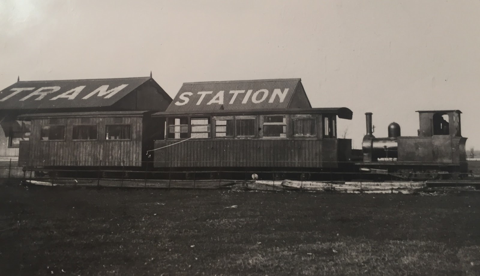
Camber golf links, Rye and Camber Tramway was a railway in East Sussex

Camber golf links, Rye and Camber Tramway was a railway in East Sussex

in 1895 the Rye and Camber Tramway was opened to connect Rye with a new golf course at Camber. 
Rye Tramway

Designed to cater for the transportation needs of golfers and their caddies, the steam railway also took fishermen from Rye to their fishing boats moored opposite Rye Harbour village, where a river ferry could be hailed.
Rye (Tramway top right )


The line's promoters cunningly decided to build the line entirely on private land, thereby avoiding the necessity of having to obtain an Act of Parliament. 


Built to a 3ft gauge with economy in mind, the 1.75 mile line ran parallel to the River Rother from its Rye terminus as far as Broadwater Beach, before heading across Northpoint beach and terminating opposite Rye Harbour Village


The track was spiked directly to wooden sleepers to save cost, and there was two loops at each end of the line to let the engines run around the coaches.

you tube clip of the tramway

The two termini were both built of corrugated iron and wood, offering a canopy, waiting room and booking office. 

With only one engine in steam at any given point, there was no need for signalling. 


When it opened on Saturday, 13th July, 1895, the line was equipped with one steam engine and a passenger coach, divided into first and second class compartments. 

The engine, named 'Camber' and accompanying carriage were built by W.G.Bagnall Limited of Stafford. 

Although capable of better things, the engine normally sauntered around the track at a stately 10mph, pulling a three ton passenger car.

The coach, divided into first and second class sections, was around twenty-six feet long with entrance platforms at each end. 

The first class portion could accommodate 12 passengers and came with cushioned seats and curtains, while the cheapskates in second class had to make do with longitudinal strip-wood seating . 
 

Traffic was encouraging, with 18,000 tickets being sold in the first six months, prompting the company to invest in a second, more powerful, steam engine in 1897, patriotically named 'Victoria'. 

The company continued to prosper, adding a half mile extension to a deserted location at Camber Sands on 13th July, 1908. 


The station was extremely low on facilities, offering nothing more than a raised platform made from old standard gauge sleepers, with a small hut being added later. 

Endeavouring to make the most of its remote location, the timetable described the station as being 'far from the madding crowd' and a perfect location for picnics. 

With the extension complete, the original Camber terminus was renamed as Golf Links, and the service ramped up in the summer months to 13 trains each way daily, of which only seven ran through to Camber Sands. 

A special Saturday late night train ran for golfers at 8:15pm. 
In the winter months, the service was cut back to seven trains each way daily, nine trips on Saturdays and four on Sunday, with all trains terminating at the Golf Links station. 

Road competition, rising coal prices and high maintenance costs forced economies on the line in the 1920s, with the steam locomotives being replaced by a four wheeled petrol tractor in 1924. 
 The winter service was abandoned completely in 1925-6 and a long period of decline set in. 

With the outbreak of war in 1939, the line was closed to the public and used by various military and naval purposes. 

 Unhappily, the track and rolling stock was in such dreadful condition at the end of the war that the company decided to wind up the railway forever. 

Although the Golf Links/Camber station has survived remarkably well for a corrugated iron structure, no trace remains of the Rye terminus or the station at Camber Sands. 


the last remains of the tramway

colonel stephens museam Tenterden


Wednesday, 22 February 2017

St Michaels Tunnel (A forgotten relic) shoreham lane Tenterden kent USA

St Michaels Tunnel the forgotten relic of the Kent and East Sussex Railway
Add caption

 One of his 'bigger' feats was St Michaels Tunnel, located just north of the halt. Opened in 1905 as part of an extension from Tenterden to Headcorn, it is just 31 yards in length and curves to the east on a radius of approximately 30 chains.The portals are neat, brick-built affairs with a masonry string course and copings. Wing walls extend outwards parallel to the track - the east-side wall at the south end is cracked top to bottom. Horseshoe shaped in profile, the lining comprises four rings of brick and features a single refuge. Timber brackets supported telegraph wires.
now a back garden
Despite almost 60 years of redundancy, the structure remains in fair condition except for the cracked wing wall and some spalling of the north portal's headwall. The interior has found function as a wood store, used by the householder whose property it stands on.
a train running through the tunnel


Wittersham Road station signal box.

Wittersham Road


Razed to the ground after complete closure by British Railways in 1961, this station has risen from the ashes under the auspices of the preserved ‘’Kent & East Sussex Railway’’ (K&ESR). Wittersham Road originally came into passenger use with the ‘’Rother Valley Railway’’ (RVR) between Robertsbridge and Tenterden on 2nd April 1900, goods traffic having commenced on 29th of the previous month. As mentioned elsewhere on the website, the line was subject to a 1⅓-mile eastward extension to a more conveniently-sited ‘’Tenterden Town’’ station, and was eventually taken as far as Headcorn, where it met the ex-SER Dover trunk line. These extensions came into use on 16th March 1903 and 15th May 1905 respectively, and the RVR became known as the K&ESR from 1904 onwards.


The line was engineered by Holman F. Stephens, and architecture was standardised along the route, a practice which had been followed by numerous of the larger railway companies nationwide. The route was single-track throughout, and in common with most stations on the line, just a single brick-built platform surface was provided at Wittersham Road. The station resided 2¼-miles northwest of the village it purported to serve, hence its ‘’Road’’ suffix, and its construction certainly seemed reminiscent of the old SER policy of providing stations at a ‘’modest cost’’! Wittersham Road’s main building was a typical unassuming H.F. Stephens affair: single-storey, it was fully fabricated from corrugated iron – as per all those structures in-between Robertsbridge and Tenterden Town exclusive – and incorporated sash-style windows. The fact that the building was erected at right angles to the platform seems to explain why it was the only station structure along the entire route to lack a canopy. The very same style of construction could be found on H.F. Stephens’ contemporary Sheppey Light Railway in North Kent, and on those railways he engineered in far flung locations in Shropshire and Wales.


Wittersham Road’s platform was lined at its rear by wire fencing, which in turn was accompanied by rectangular-shaped gas lamps supported upon wooden posts. Behind the platform could be found the station’s goods facilities, which comprised a pair of Tenterden-facing sidings, access to which was controlled from a lever frame positioned north east of the layout. Signalling at the site was primitive, simply comprising a double-armed semaphore post at the Robertsbridge end of the station platform, which resided immediately adjacent to a level crossing. The latter was protected by a pair of timber gates, to which were affixed a red warning diamond, as opposed to the more customary circle. This was not unique to Wittersham Road, a number of other level crossings along the route being similarly treated. It is worth noting that the station lacked a loop, thus it was not possible for trains to pass in the station (unless, in an extreme case, a train service was stabled in the goods yard to let another pass!).

Naturally, the station led a quiet existence on a decidedly rural route, but the monotony was broken as a result of World War II. In February 1941, the goods yard became host to a 32-ton rail-mounted gun, which could fire 9.2-inch diameter shells, and had a range of twenty miles. Thus, in the event of an invasion, the gun’s fire was able to hit the coastline of the Romney Marsh. The gun was not used in anger, although was test fired, and to move the colossus, an ex-GWR 0-6-0 ‘’Dean Goods’’ locomotive, now under ‘’War Department’’ ownership, was provided on the line. The locomotive was also used to move an identical gun based at Rolvenden. To accommodate the gun at Wittersham Road, an ammunition store was erected in the goods yard, as was a gun crew hut. A military presence remained at the station until August 1944.


Tuesday, 21 February 2017

Lydd Town Station (formely Lydd Station)

Urban Exploration: Abandoned Train Station in Lydd Kent .

One of my favourite abandoned stations
Lydd Town Station (formerly Lydd Station) (Closed) and Lydd Town Crossing
Opened on 7 December 1881 as Lydd Station, on 4 July 1937 the station was renamed Lydd Town to prevent confusion with a newly opened station at Lydd-on-Sea.


Lydd Town Station was a substantial facility, with a large goods yard and much passenger and freight traffic generated by nearby army camps. A branch ran south from the goods yard into the army camps, which were served by Lydd Military Railway. A passing loop was provided at the station, but this has subsequently been lifted. The station was closed to passenger traffic on 6 March 1967 and to freight on 4 October 1971. Part of the site is now used as a recycling facility. There is a possibility that gravel extraction will restart south of the station, and, if so, the passing loop may be reinstated to allow locomotives to change ends and shunt the train.


If open today Lydd Town Station would serve a growing town, which is just south west of the site, and a short extension to the line could also provide much improved transport facilities to Lydd Airport (also known as London Ashford), linking directly to Ashford International Station.


The branch actually runs south east from Appledore. The convention adopted in these collections is that Appledore is north, Dungeness is south, the New Romney side of the branch is east, and the Lydd side of the branch
Urban exploring is a great way to explore your local community
 
Lydd today

Popular Posts